Paths are just lines, connecting point A to point B. When I say lines, I don't mean just strait lines, you can drag, point, or click anywhere on your map to create your story. Paths don't have to be tied to the ground either, you can have them float above the ground and/or even have it's lines extend to the ground.
So what stories can you tell with Paths? I have seen and used them for many different things, from Civil War Marching routes, Grandpa's walk to school: you know... "up hill both ways" maybe you have a story of taking the wagon train west. How about a old hunting trail, I have even used it to map a bombing mission route from England to Germany.
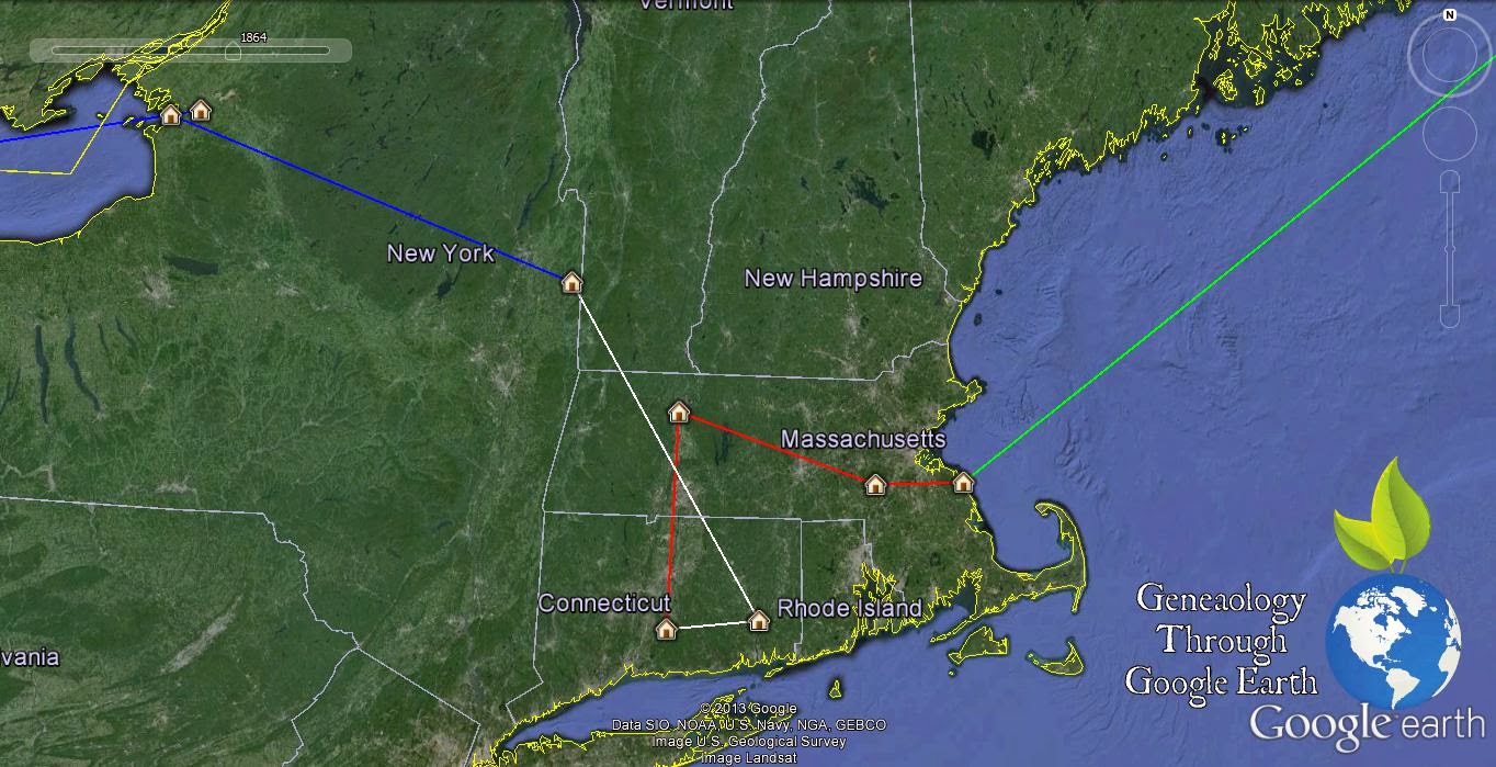
So here is what I have to show you today. This is a path I have created showing the migration path of the family line of the Sutlief from my 11th Great grandfather Abraham Sutlief to my last move to Kansas City Missouri. I am not going to go through the whole story with you but my family arrived in the Americas about 1623 and stayed in the Northeast until after the War of 1812. Then after the early death of John Sutlief in 1835 one George Washington Sutlief decided to head to the Wild West of the Territory Kansas. The Sutlief's stay in the Atchison, Kansas area for a few generations with a small stint in Ft Carson CO during Vietnam. Then back to Atchison before moving to what I now call home Kansas City MO.
So what trail will you draw to document your family. Will it be the summer vacation to grandma's house, or who your family crosses the Atlantic Ocean from Denmark to the great Mississippi River before taking the wagon train to Salt Lake City. Leave a Comment and Share how you might create a Path in your own globe of Google Earth.
No comments:
Post a Comment